|
|
|
|
|
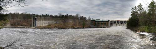
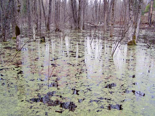
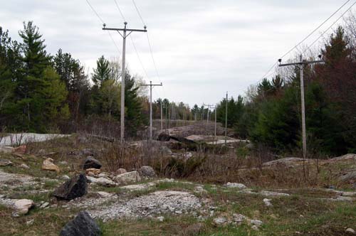
Don Mincoff and I took our third trip together to Swift Rapids Dam - a place where Don's father worked and where his family lived on the small colony servicing the hydro-electric facility. Don spent his early childhood in this remote place and has many fond memories of the place, which is good because most of the place has fallen down, the colony no longer required due to automation. The first time we ventured to the dam was a cold fall day, a bitter, windy, rainy day and the canoe seemed the wrong choice at first for the long journey down the river. However, we held our resolve and made the journey to the top of the dam (and back!) and in through the back bay and tied our canoe to a small dock. I thought it funny that with no signposts the people in the area named almost everything - a group of tiny islands was called the three sisters, etc. We returned two years ago by SUV (you can't make it in a car) by way of a very crude service road following along the twin hydro pole line carrying the power out from the dam (see my pictures here). Many years ago there was no road and the only way in was the water. After a break of a year we returned in the spring of 2008. Due to the heavy flooding in the central area of Ontario the floodgates were open and the flow screamed out along the flumes and into the river below. We were told that it would take about 36 days to bring the level of Lake Simcoe down so the fast current would continue for some time. Looking at the picture above you see first the elevated Swift Rapid Lock (#43) structure running from the left to right. The lock replaced the earlier marine railway. The Hydro Electric turbines and power station sits in the building just to the left of the dam, while the chutes of the dam are at the right side of the picture. The power line crosses the water towards the right - leading also to the location of the colony. You can see a blow up of the picture at the bottom of this page. You can find some great information on the Trent-Severn Waterway (between Ontario and Georgian Bay) at this site. The road is not paved with gold The roads go from asphalt to gravel and finally into a narrow service road which seems to wind between all the beaver dams and ponds. Everything in this area seems to be bush, rock or swamp, sometimes with all three combined. The swamps and puddles remaining from the spring melt are murky and full of life. We pass one fallen tree, leaning in the water, which has been the meeting point for a number of turtles. This same tree was full of turtles when we came in the fall - it's like the diner in 90210, just for turtles. The beavers have made many of the dams along the edge of the road and last year some of the water held back by the dam was above the road. They seem to have done quite a bit to fix the road and new plastic culverts have replaced many of the old rusted ones.
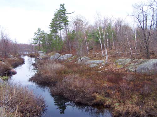
The rolling rocks of the Canadian Shield become exposed along the journey. Massive mounds of minerals which compressed and hardened and then seem to buckle in gentle curves, enjoying the sun where the road runs along the rocks. The contours of the land are perfect for catching water or as a base for a nice bush but not for a straight road! The road is signed - use at your own risk. Many of the hydro poles used explosives or anchor bolts drilled into the rock to support the poles. The twin poleline leads towards the dam.
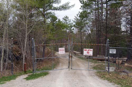
The route takes an hour or two to traverse and hummer tours and ATVs fare the best in these conditions while in winter snowmobile paths criss cross the area. At the end of the service road is the gates of the dam facility with a small opening to allow people to wander in.
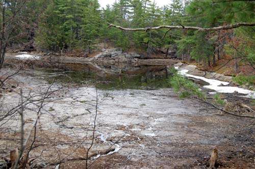
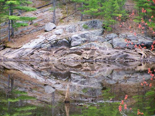
Frankly my dear, I don't give a dam The spring melt fills the Trent-Severn waterway and they need to move the water through the river to reduce and/or to prevent flooding. The river is allowed to drop substantially in some areas to allow the water to quickly flow through the system. The back bay adjacent to the dam only has some standing pools of water, otherwise the tree stumps and sediment start to dry in the sun. You can see the harsh line of the normal water level along the shore. The water and the slope of the rock carries away leaves and soil and the bare rock usually remains under water. Surprisingly there was still a trace of winter's ice along one edge of the back bay and the last water allows for a nice reflection shot.
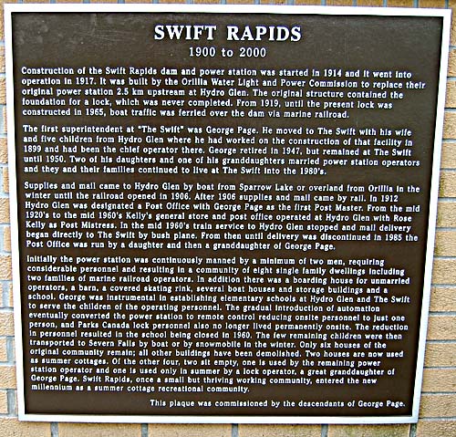
The dam's first superintendent was George Page and his family placed the following plaque on site. Click here for a blow up of the plaque.
For more of our trip please click here to continue to the next page. |

Current
page hit count
thanks for dropping by!